Brayton Station (remains)
Introduction
The photograph on this page of Brayton Station (remains) by Ben Brooksbank as part of the Geograph project.
The Geograph project started in 2005 with the aim of publishing, organising and preserving representative images for every square kilometre of Great Britain, Ireland and the Isle of Man.

There are currently over 7.5m images from over 14,400 individuals and you can help contribute to the project by visiting https://www.geograph.org.uk
Brayton Station (remains)
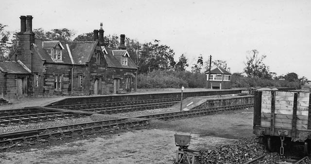
Image: © Ben Brooksbank Taken: 25 Sep 1961
View NE, towards Carlisle (and former junction with SJR); ex-Maryport & Carlisle main line and junction with Solway Junction Railway (SJR). Brayton station closed to passengers on 5/6/50, to goods 27/9/65. The southern portion of the SJR from Brayton to Annan over the Solway Viaduct had been closed in 9/21. See also Image Note the rather striking architecture - and it seems that after 11 years the station here was 'privatised'.
Images are licensed for reuse under creativecommons.org/licenses/by-sa/2.0
Image Location
Latitude
54.780513
Longitude
-3.299774