Rusty boiler - Haverholme
Introduction
The photograph on this page of Rusty boiler - Haverholme by Mick Lobb as part of the Geograph project.
The Geograph project started in 2005 with the aim of publishing, organising and preserving representative images for every square kilometre of Great Britain, Ireland and the Isle of Man.

There are currently over 7.5m images from over 14,400 individuals and you can help contribute to the project by visiting https://www.geograph.org.uk
Rusty boiler - Haverholme
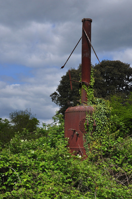
Image: © Mick Lobb Taken: 16 May 2010
The 'boiler' is at the end of a narrow gauge line set on a concrete base. I have no idea as to its purpose but can only imagine that it has been used in some agricultural process or that of gravel extraction given its location in the fenlands adjacent to what is now a carp fishing lake.
Images are licensed for reuse under creativecommons.org/licenses/by-sa/2.0
Image Location
Latitude
53.019944
Longitude
-0.337482