Watford: Former Beulah Chapel, Loates Lane
Introduction
The photograph on this page of Watford: Former Beulah Chapel, Loates Lane by Nigel Cox as part of the Geograph project.
The Geograph project started in 2005 with the aim of publishing, organising and preserving representative images for every square kilometre of Great Britain, Ireland and the Isle of Man.

There are currently over 7.5m images from over 14,400 individuals and you can help contribute to the project by visiting https://www.geograph.org.uk
Watford: Former Beulah Chapel, Loates Lane
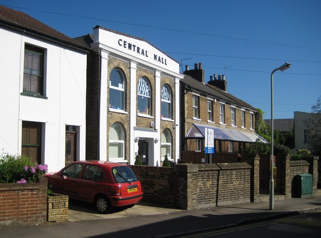
Image: © Nigel Cox Taken: 23 May 2010
The building was constructed in 1869 as a Beulah Chapel, and has had several occupiers since. Today it in use as a nursery. There is a rather fine grouping of Victorian terraced houses beyond.
Images are licensed for reuse under creativecommons.org/licenses/by-sa/2.0
Image Location
Latitude
51.658173
Longitude
-0.392947