Parish Hall, Henlow, Beds
Introduction
The photograph on this page of Parish Hall, Henlow, Beds by Rodney Burton as part of the Geograph project.
The Geograph project started in 2005 with the aim of publishing, organising and preserving representative images for every square kilometre of Great Britain, Ireland and the Isle of Man.

There are currently over 7.5m images from over 14,400 individuals and you can help contribute to the project by visiting https://www.geograph.org.uk
Parish Hall, Henlow, Beds
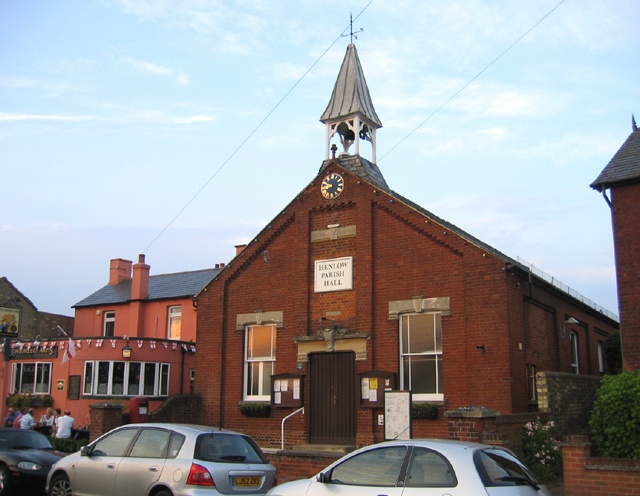
Image: © Rodney Burton Taken: 15 Jun 2006
The hall was opened in 1893 for ‘the use of the Vicar of Henlow’ and was therefore known as ‘The Vicars’ Clubroom’. http://www.henlow.net/phall.htm It stands beside the Engineers Arms on the High Street.
Images are licensed for reuse under creativecommons.org/licenses/by-sa/2.0
Image Location
Latitude
52.031798
Longitude
-0.285704