Daybrook
Introduction
The photograph on this page of Daybrook by John Sutton as part of the Geograph project.
The Geograph project started in 2005 with the aim of publishing, organising and preserving representative images for every square kilometre of Great Britain, Ireland and the Isle of Man.

There are currently over 7.5m images from over 14,400 individuals and you can help contribute to the project by visiting https://www.geograph.org.uk
Daybrook
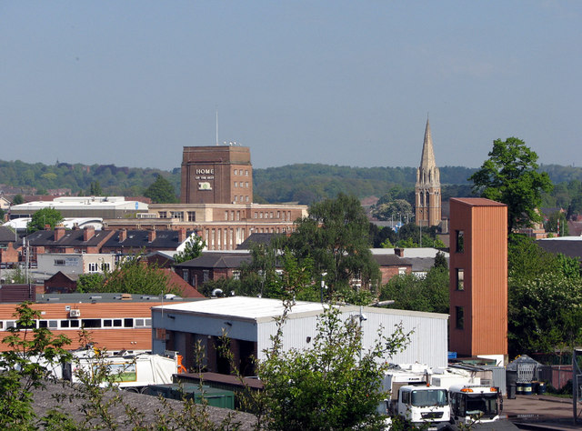
Image: © John Sutton Taken: 18 May 2010
A view of Daybrook, taken from the former railway embankment east of B&Q. The two most prominent landmarks are the tower of the former Home Brewery (now Nottinghamshire County Council offices), designed by T Cecil Howitt, architect of Nottingham Council House, and the spire of St Paul's Church - "1892-6, by Pearson of Truro Cathedral, indeed with the same tall spire on the pattern of Coutances," according to Nikolaus Pevsner.
Images are licensed for reuse under creativecommons.org/licenses/by-sa/2.0
Image Location
Latitude
52.997027
Longitude
-1.136383