Bowling Junction Station (remains)
Introduction
The photograph on this page of Bowling Junction Station (remains) by Ben Brooksbank as part of the Geograph project.
The Geograph project started in 2005 with the aim of publishing, organising and preserving representative images for every square kilometre of Great Britain, Ireland and the Isle of Man.

There are currently over 7.5m images from over 14,400 individuals and you can help contribute to the project by visiting https://www.geograph.org.uk
Bowling Junction Station (remains)
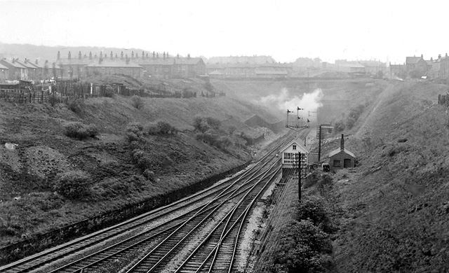
Image: © Ben Brooksbank Taken: 22 Apr 1961
View southward, towards Low Moor; ex-L&Y main lines into Bradford Exchange. The lines on the right come Bradford Exchange, those on the left are an ex-GNR loop from Laisterdyke (closed 9/6/69). The station was closed on 3/12/51, but the line from Bradford remains, now (since 1/73) coming from Bradford Interchange.
Images are licensed for reuse under creativecommons.org/licenses/by-sa/2.0
Image Location
Latitude
53.774264
Longitude
-1.748391