Green lane from Height Gate to Strait Hey, Erringden
Introduction
The photograph on this page of Green lane from Height Gate to Strait Hey, Erringden by Humphrey Bolton as part of the Geograph project.
The Geograph project started in 2005 with the aim of publishing, organising and preserving representative images for every square kilometre of Great Britain, Ireland and the Isle of Man.

There are currently over 7.5m images from over 14,400 individuals and you can help contribute to the project by visiting https://www.geograph.org.uk
Green lane from Height Gate to Strait Hey, Erringden
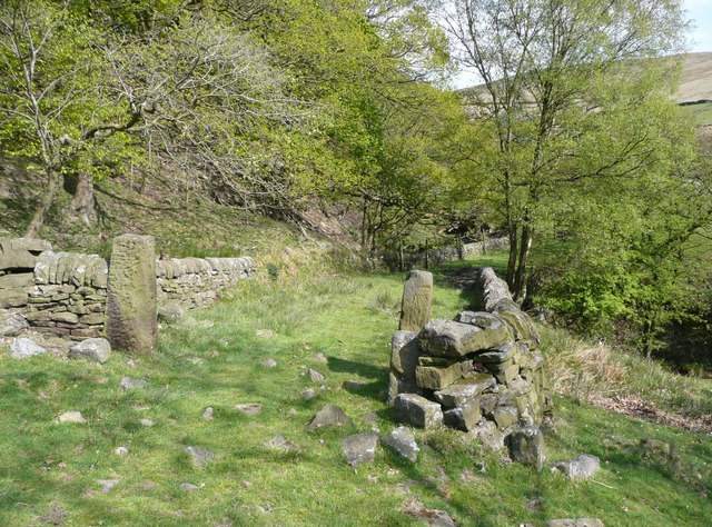
Image: © Humphrey Bolton Taken: 17 May 2010
This passes through the ancient Sowerby Ramble, a narrow strip of land surrounding the medieval hunting park that eventually became the township of Erringden. There are two roughly parallel township boundaries on the 1850 map, and between them the name 'Ramble Wood'. The gatepost on the right has a carving that I could not decypher.
Images are licensed for reuse under creativecommons.org/licenses/by-sa/2.0
Image Location
Latitude
53.7214
Longitude
-2.042394