Britannia Halt (remains)
Introduction
The photograph on this page of Britannia Halt (remains) by Ben Brooksbank as part of the Geograph project.
The Geograph project started in 2005 with the aim of publishing, organising and preserving representative images for every square kilometre of Great Britain, Ireland and the Isle of Man.

There are currently over 7.5m images from over 14,400 individuals and you can help contribute to the project by visiting https://www.geograph.org.uk
Britannia Halt (remains)
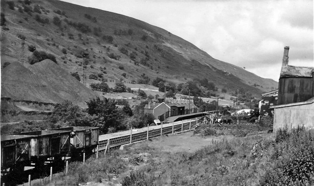
Image: © Ben Brooksbank Taken: 14 Jul 1966
View NW, towards Brynmawr; ex-GWR Newport - Aberbeeg - Brynmawr line. This Halt, called Tyler's Arms until 1933, was between Abertillery and Blaina and was closed on 30/4/62, when the passenger service on the branch ceased; the line was used for coal traffic until 30/7/78.
Images are licensed for reuse under creativecommons.org/licenses/by-sa/2.0
Image Location
Latitude
51.750147
Longitude
-3.156501