High Trees
Introduction
The photograph on this page of High Trees by Ian Capper as part of the Geograph project.
The Geograph project started in 2005 with the aim of publishing, organising and preserving representative images for every square kilometre of Great Britain, Ireland and the Isle of Man.

There are currently over 7.5m images from over 14,400 individuals and you can help contribute to the project by visiting https://www.geograph.org.uk
High Trees
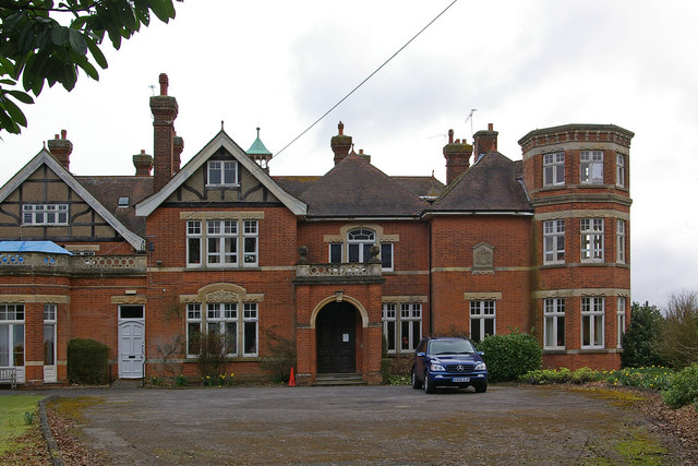
Image: © Ian Capper Taken: 5 Apr 2010
This house, originally called Horsehills, was built in 1901 by a Mr Bernard W Parsons, a master butcher who lived at nearby Wrays, for his invalid wife. From 1930 to 1984 it was used as a prep school (with the exception of during the Second World War, when from 1940 to 1945 the school was evacuated to Woolacombe in Devon, with the house being occupied by the RAF and ATS). The name High Trees was transferred to the building when the school moved here in 1930. Following the school's closure, it was converted into a nursing home, retaining the name High Trees, for the period from 1986 to the early 2000s. Planning permission has now been given for conversion to residential use. The building is locally listed.
Images are licensed for reuse under creativecommons.org/licenses/by-sa/2.0
Image Location
Latitude
51.181085
Longitude
-0.207394