The Holsworthy Union Workhouse
Introduction
The photograph on this page of The Holsworthy Union Workhouse by Humphrey Bolton as part of the Geograph project.
The Geograph project started in 2005 with the aim of publishing, organising and preserving representative images for every square kilometre of Great Britain, Ireland and the Isle of Man.

There are currently over 7.5m images from over 14,400 individuals and you can help contribute to the project by visiting https://www.geograph.org.uk
The Holsworthy Union Workhouse
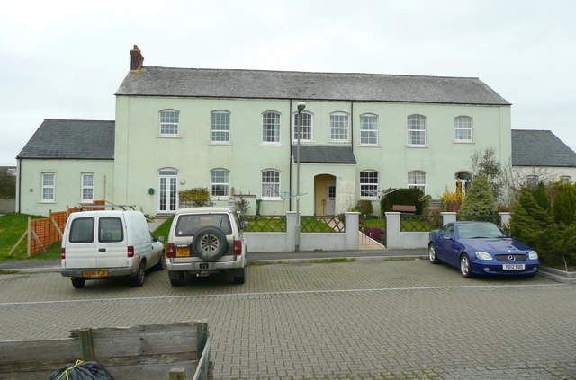
Image: © Humphrey Bolton Taken: 6 Apr 2010
Built in 1857, and became the Dawfield Hospital. Now flats and houses. The Holsworthy Poor Law Union included a large number of the surrounding civil parishes. PLUs were abolished in 1930 and their functions transferred to the county councils.
Images are licensed for reuse under creativecommons.org/licenses/by-sa/2.0
Image Location
Latitude
50.813499
Longitude
-4.357696