Plumstead windmill
Introduction
The photograph on this page of Plumstead windmill by Stephen Craven as part of the Geograph project.
The Geograph project started in 2005 with the aim of publishing, organising and preserving representative images for every square kilometre of Great Britain, Ireland and the Isle of Man.

There are currently over 7.5m images from over 14,400 individuals and you can help contribute to the project by visiting https://www.geograph.org.uk
Plumstead windmill
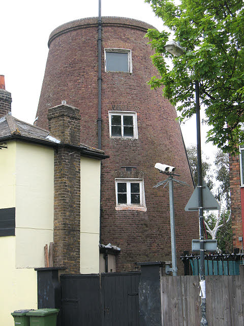
Image: © Stephen Craven Taken: 9 May 2010
The brick tower is the remains of an 18th century windmill. The site was an obvious one, on the top of the escarpment on the edge of Plumstead Common where it would make the most of the prevailing wind. The tower is grade 2 listed (listed building no. 200464) and appears to have been converted to residential use.
Images are licensed for reuse under creativecommons.org/licenses/by-sa/2.0
Image Location
Latitude
51.481704
Longitude
0.084032