Post Office Alley
Introduction
The photograph on this page of Post Office Alley by Martin Addison as part of the Geograph project.
The Geograph project started in 2005 with the aim of publishing, organising and preserving representative images for every square kilometre of Great Britain, Ireland and the Isle of Man.

There are currently over 7.5m images from over 14,400 individuals and you can help contribute to the project by visiting https://www.geograph.org.uk
Post Office Alley
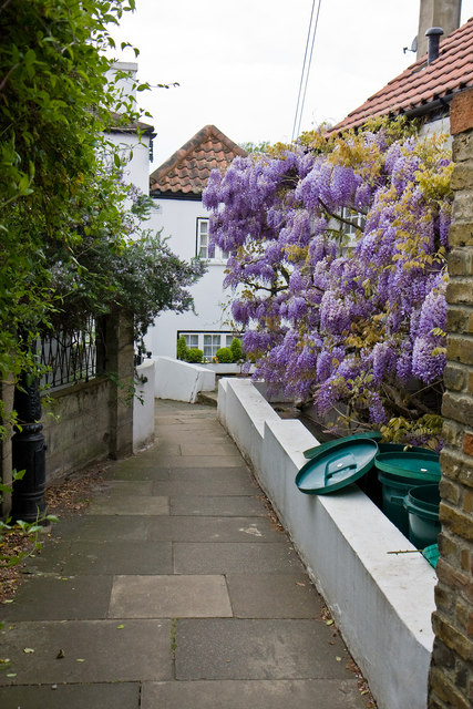
Image: © Martin Addison Taken: 7 May 2010
Leading between Thames Road and the riverside walk Strand-on-the-Green, this alley got its name because it actually led to a post office, though where that building was I have been unable to ascertain. The houses at the end look as if they block the path but the one on the left, which dates to 1752, has its first floor built over the path and a low narrow tunnel at ground level allow access through the property to the riverside walk.
Images are licensed for reuse under creativecommons.org/licenses/by-sa/2.0
Image Location
Latitude
51.485439
Longitude
-0.279195