Manor Arms, Mitcham Lane
Introduction
The photograph on this page of Manor Arms, Mitcham Lane by Stephen Richards as part of the Geograph project.
The Geograph project started in 2005 with the aim of publishing, organising and preserving representative images for every square kilometre of Great Britain, Ireland and the Isle of Man.

There are currently over 7.5m images from over 14,400 individuals and you can help contribute to the project by visiting https://www.geograph.org.uk
Manor Arms, Mitcham Lane
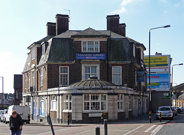
Image: © Stephen Richards Taken: Unknown
On the corner of Babington Road, built c1920 on the site of a mansion, Manor Park House. The ground floor has faience pilasters and is surmounted by a shallow dome. It is within the Streatham High Road and Streatham Hill Conservation Area. Information from Lambeth Council (http://www.lambeth.gov.uk/NR/exeres/CE4B5CE1-0387-40ED-B5A9-273A5160C34A.htm ). Sorry lady, you just weren't quick enough.
Images are licensed for reuse under creativecommons.org/licenses/by-sa/2.0
Image Location
Latitude
51.428332
Longitude
-0.132023