South from Imperial Wharf Station
Introduction
The photograph on this page of South from Imperial Wharf Station by Ian Capper as part of the Geograph project.
The Geograph project started in 2005 with the aim of publishing, organising and preserving representative images for every square kilometre of Great Britain, Ireland and the Isle of Man.

There are currently over 7.5m images from over 14,400 individuals and you can help contribute to the project by visiting https://www.geograph.org.uk
South from Imperial Wharf Station
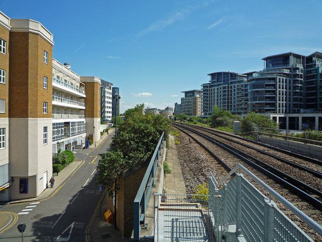
Image: © Ian Capper Taken: 6 May 2010
Looking along the West London Line towards Cremorne Bridge over the Thames, with Harbour Yard on the left and Chelsea Crescent beyond, and with Regency House, Chelsea Vista, Harbour Reach, Thames Point and Waterside Tower on the right. The buildings in the far distance are Oyster wharf, on the south bank of the Thames. The West London Line has now received a new lease of life as part of the London Overground network, which has involved the building of new stations, including this one at Imperial Wharf, opened in 2009.
Images are licensed for reuse under creativecommons.org/licenses/by-sa/2.0
Image Location
Latitude
51.473265
Longitude
-0.181003