Bozomzeal
Introduction
The photograph on this page of Bozomzeal by Derek Harper as part of the Geograph project.
The Geograph project started in 2005 with the aim of publishing, organising and preserving representative images for every square kilometre of Great Britain, Ireland and the Isle of Man.

There are currently over 7.5m images from over 14,400 individuals and you can help contribute to the project by visiting https://www.geograph.org.uk
Bozomzeal
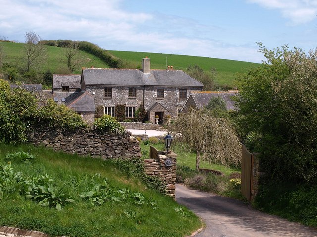
Image: © Derek Harper Taken: 3 May 2010
Or Bosomzeal. See also Image and Image The attractive farmhouse sits so neatly in the valley head that it is difficult to resist taking further photographs. There is a detailed listed building description at http://www.imagesofengland.org.uk/Details/Default.aspx?id=101161&mode=adv .
Images are licensed for reuse under creativecommons.org/licenses/by-sa/2.0
Image Location
Latitude
50.371653
Longitude
-3.599222