Tadworth Water Tower
Introduction
The photograph on this page of Tadworth Water Tower by Ian Capper as part of the Geograph project.
The Geograph project started in 2005 with the aim of publishing, organising and preserving representative images for every square kilometre of Great Britain, Ireland and the Isle of Man.

There are currently over 7.5m images from over 14,400 individuals and you can help contribute to the project by visiting https://www.geograph.org.uk
Tadworth Water Tower
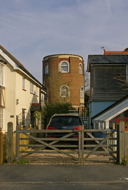
Image: © Ian Capper Taken: 24 Apr 2010
Originally built for the Sutton Water Company in 1898. It had ceased to be a water tower by 1925, with the tank removed to the company's Woodmansterne depot, for oil storage. The tower itself was sold and was converted to residential use. It is locally listed.
Images are licensed for reuse under creativecommons.org/licenses/by-sa/2.0
Image Location
Latitude
51.287013
Longitude
-0.232958