Heritage Hall, Peterculter
Introduction
The photograph on this page of Heritage Hall, Peterculter by Stanley Howe as part of the Geograph project.
The Geograph project started in 2005 with the aim of publishing, organising and preserving representative images for every square kilometre of Great Britain, Ireland and the Isle of Man.

There are currently over 7.5m images from over 14,400 individuals and you can help contribute to the project by visiting https://www.geograph.org.uk
Heritage Hall, Peterculter
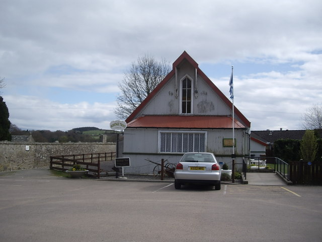
Image: © Stanley Howe Taken: 22 Apr 2010
Peterculter. Formerly an 'Iron Kirkie' in Ballater, it was moved here in 1907 to be used as the church hall. Together with the adjacent Heritage Centre (ex St Peter's Church) it has been in the care of St Peter's Heritage Trust since 1999.
Images are licensed for reuse under creativecommons.org/licenses/by-sa/2.0
Image Location
Latitude
57.094489
Longitude
-2.263533