Ysgoldy Capel Ebenezer, Y Ff?r
Introduction
The photograph on this page of Ysgoldy Capel Ebenezer, Y Ff?r by Eric Jones as part of the Geograph project.
The Geograph project started in 2005 with the aim of publishing, organising and preserving representative images for every square kilometre of Great Britain, Ireland and the Isle of Man.

There are currently over 7.5m images from over 14,400 individuals and you can help contribute to the project by visiting https://www.geograph.org.uk
Ysgoldy Capel Ebenezer, Y Ff?r
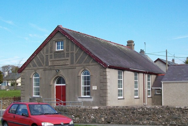
Image: © Eric Jones Taken: 23 Apr 2010
Ysgoldy means "schoolroom". This was the vestry of Capel Ebenezer, the Calvinistic Methodist chapel built at the crossroads in the second half of the 19thC. Ebenezer chapel has now been demolished and the vestry is used for Sunday service. The site of the chapel is now a car park.
Images are licensed for reuse under creativecommons.org/licenses/by-sa/2.0
Image Location
Latitude
52.92515
Longitude
-4.385449