West Barton Farm
Introduction
The photograph on this page of West Barton Farm by Derek Harper as part of the Geograph project.
The Geograph project started in 2005 with the aim of publishing, organising and preserving representative images for every square kilometre of Great Britain, Ireland and the Isle of Man.

There are currently over 7.5m images from over 14,400 individuals and you can help contribute to the project by visiting https://www.geograph.org.uk
West Barton Farm
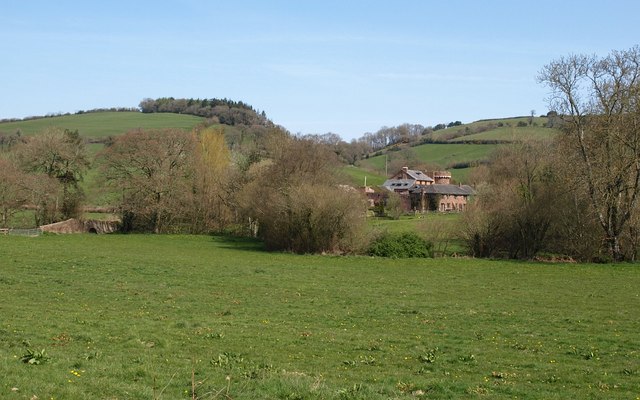
Image: © Derek Harper Taken: 22 Apr 2010
The farm comes complete with castellated tower, which I think is modern. This must be taken from the same point on Cadeleigh Bridleway 4 as Image On the left is Dart Bridge, site of an incident in September 2008 when the Dart burst its banks and a lorry was trapped in four feet of water. On the hill is Oldridge Wood.
Images are licensed for reuse under creativecommons.org/licenses/by-sa/2.0
Image Location
Latitude
50.874032
Longitude
-3.532074