Portsmouth, Cliviger Fault
Introduction
The photograph on this page of Portsmouth, Cliviger Fault by charlieboyce as part of the Geograph project.
The Geograph project started in 2005 with the aim of publishing, organising and preserving representative images for every square kilometre of Great Britain, Ireland and the Isle of Man.

There are currently over 7.5m images from over 14,400 individuals and you can help contribute to the project by visiting https://www.geograph.org.uk
Portsmouth, Cliviger Fault
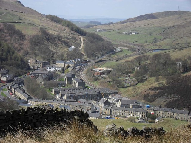
Image: © charlieboyce Taken: 22 Apr 2010
Looking north-west up the Cliviger Fault from south side of valley above Cornholme. The school is in the lower right quadrant of the photo and the railway line goes to Burnley. The housing is a mix of Victorian terraces and late 20th century flats. Industrial buildings are also prominent, the large white building is a pub. Portsmouth is sqeezed into a narrow valley with steep sides leading to areas of moorland.
Images are licensed for reuse under creativecommons.org/licenses/by-sa/2.0
Image Location
Latitude
53.731918
Longitude
-2.151542