Dorchester Court, Leigham Court Road
Introduction
The photograph on this page of Dorchester Court, Leigham Court Road by Stephen Richards as part of the Geograph project.
The Geograph project started in 2005 with the aim of publishing, organising and preserving representative images for every square kilometre of Great Britain, Ireland and the Isle of Man.

There are currently over 7.5m images from over 14,400 individuals and you can help contribute to the project by visiting https://www.geograph.org.uk
Dorchester Court, Leigham Court Road
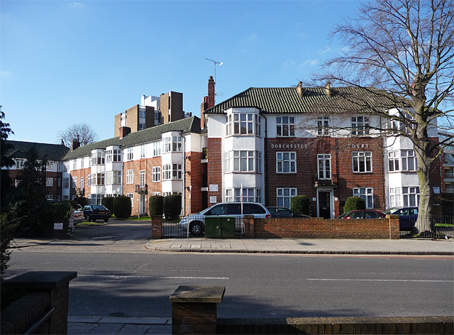
Image: © Stephen Richards Taken: Unknown
A residential scheme laid out and designed by H.W. Binns in 1935. A mixture of red brick, white rendering, green pantile roofs, together with full-height canted bays. It is within the Streatham High Road and Streatham Hill Conservation Area. Information from Lambeth Council (http://www.lambeth.gov.uk/NR/exeres/CE4B5CE1-0387-40ED-B5A9-273A5160C34A.htm ).
Images are licensed for reuse under creativecommons.org/licenses/by-sa/2.0
Image Location
Latitude
51.436593
Longitude
-0.125643