Corner Fielde, Streatham Hill
Introduction
The photograph on this page of Corner Fielde, Streatham Hill by Stephen Richards as part of the Geograph project.
The Geograph project started in 2005 with the aim of publishing, organising and preserving representative images for every square kilometre of Great Britain, Ireland and the Isle of Man.

There are currently over 7.5m images from over 14,400 individuals and you can help contribute to the project by visiting https://www.geograph.org.uk
Corner Fielde, Streatham Hill
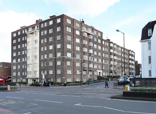
Image: © Stephen Richards Taken: Unknown
This imposing block of flats was designed by Toms and Partners in 1937. Happily, the original metal Crittall-style windows seem to have survived. The original sales brochure boasted, "constant softened hot water ... separate tradesmen's entrance ... from £105 p.a". It is within the Streatham High Road and Streatham Hill Conservation Area. The course of Streatham High Road has been a major highway between London and Sussex since Roman times. Its current appearance is largely attributable to two major spells of development. The first was during the late C19th following the opening of Streatham Hill station in 1856, and the second was after 1911 when the line to Victoria was electrified. Though much-maligned and undoubtedly blighted by heavy traffic, closer examination reveals that the road is lined with a number of interesting buildings, some of which reflect the period between the wars when Streatham was a fashionable centre of entertainment. Information from Lambeth Council (http://www.lambeth.gov.uk/NR/exeres/CE4B5CE1-0387-40ED-B5A9-273A5160C34A.htm ).
Images are licensed for reuse under creativecommons.org/licenses/by-sa/2.0
Image Location
Latitude
51.442315
Longitude
-0.123538