Industrial units, St Helens Canal
Introduction
The photograph on this page of Industrial units, St Helens Canal by Chris Denny as part of the Geograph project.
The Geograph project started in 2005 with the aim of publishing, organising and preserving representative images for every square kilometre of Great Britain, Ireland and the Isle of Man.

There are currently over 7.5m images from over 14,400 individuals and you can help contribute to the project by visiting https://www.geograph.org.uk
Industrial units, St Helens Canal
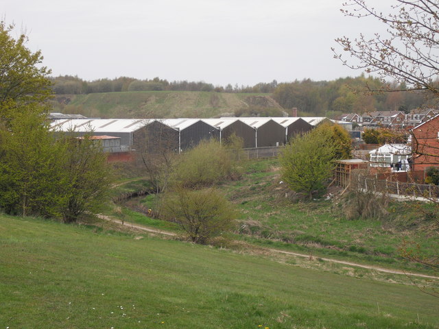
Image: © Chris Denny Taken: 23 Apr 2010
A mixture of industrial sheds and relatively modern housing line the banks of the disused canal. The 'linear park' along the canal is called the Ravenhead Greenway. In the background can be seen the slopes of the Burgie Banks, huge spoil heaps of waste from the glass industry.
Images are licensed for reuse under creativecommons.org/licenses/by-sa/2.0
Image Location
Latitude
53.459929
Longitude
-2.719427