Upper House Farm, Eardisley
Introduction
The photograph on this page of Upper House Farm, Eardisley by Philip Pankhurst as part of the Geograph project.
The Geograph project started in 2005 with the aim of publishing, organising and preserving representative images for every square kilometre of Great Britain, Ireland and the Isle of Man.

There are currently over 7.5m images from over 14,400 individuals and you can help contribute to the project by visiting https://www.geograph.org.uk
Upper House Farm, Eardisley
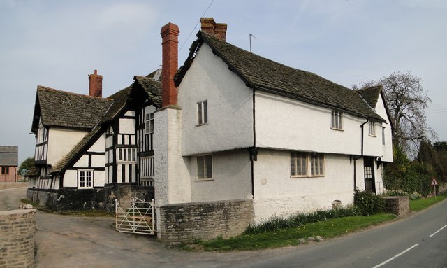
Image: © Philip Pankhurst Taken: 24 Apr 2010
A gem of a medieval house at the entrance to the village. In need of some loving care and attention. Equally ancient barns to the rear.
Images are licensed for reuse under creativecommons.org/licenses/by-sa/2.0
Image Location
Latitude
52.141273
Longitude
-3.008789