The Deansgate
Introduction
The photograph on this page of The Deansgate by Gerald England as part of the Geograph project.
The Geograph project started in 2005 with the aim of publishing, organising and preserving representative images for every square kilometre of Great Britain, Ireland and the Isle of Man.

There are currently over 7.5m images from over 14,400 individuals and you can help contribute to the project by visiting https://www.geograph.org.uk
The Deansgate
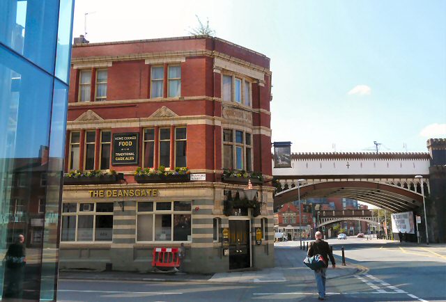
Image: © Gerald England Taken: 22 Apr 2010
At the corner of Trafford Street. The first bridge carries the Metrolink tramway whilst the one further in the background carries the main railway line. On the left is a small corner of the Hilton Hotel Image Its sign Image depicts Manchester's Victorian trams.
Images are licensed for reuse under creativecommons.org/licenses/by-sa/2.0
Image Location
Latitude
53.475045
Longitude
-2.251116