St Michaels
Introduction
The photograph on this page of St Michaels by Ian Capper as part of the Geograph project.
The Geograph project started in 2005 with the aim of publishing, organising and preserving representative images for every square kilometre of Great Britain, Ireland and the Isle of Man.

There are currently over 7.5m images from over 14,400 individuals and you can help contribute to the project by visiting https://www.geograph.org.uk
St Michaels
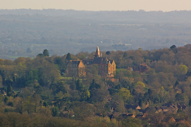
Image: © Ian Capper Taken: 15 Apr 2010
A former boarding school, initially for children of missionaries, run by the Church Missionary Society, and later a girls' school, it was built in 1886 by John Norton. It closed in 1996 and has now been converted to apartments. Grade II listed - for listing particulars see www.historicengland.org.uk/listing/the-list/list-entry/1268299. Seen here from the North Downs Way below Clarks Lane.
Images are licensed for reuse under creativecommons.org/licenses/by-sa/2.0
Image Location
Latitude
51.253954
Longitude
0.012264