Castle Club, Broomhouse Lane
Introduction
The photograph on this page of Castle Club, Broomhouse Lane by Derek Harper as part of the Geograph project.
The Geograph project started in 2005 with the aim of publishing, organising and preserving representative images for every square kilometre of Great Britain, Ireland and the Isle of Man.

There are currently over 7.5m images from over 14,400 individuals and you can help contribute to the project by visiting https://www.geograph.org.uk
Castle Club, Broomhouse Lane
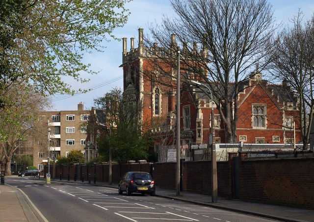
Image: © Derek Harper Taken: 15 Apr 2010
"The Elizabethan Schools, now the Castle Club, in Broomhouse Lane, was a ragged school and almshouses, founded in 1855 by Laurence Sulivan" http://www.prara.org.uk/whereisprara.html . Plans and elevations are at http://www.unmodlondon.co.uk/pdf/The_Castle.pdf . The listed building description is at http://www.imagesofengland.org.uk/Details/Default.aspx?id=201766&mode=adv .
Images are licensed for reuse under creativecommons.org/licenses/by-sa/2.0
Image Location


Leaflet Map data © OpenStreetMap
Latitude
51.467317
Longitude
-0.198243