What was it for?
Introduction
The photograph on this page of What was it for? by Christine Johnstone as part of the Geograph project.
The Geograph project started in 2005 with the aim of publishing, organising and preserving representative images for every square kilometre of Great Britain, Ireland and the Isle of Man.

There are currently over 7.5m images from over 14,400 individuals and you can help contribute to the project by visiting https://www.geograph.org.uk
What was it for?
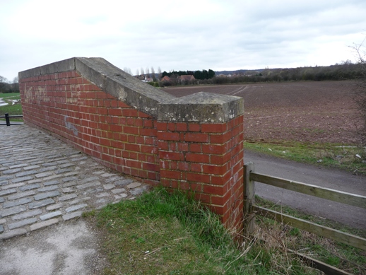
Image: © Christine Johnstone Taken: 31 Mar 2010
A bridge like this normally lifts the towpath over a canal branch or arm and there is nothing but ground underneath, and no sign of a waterway in the field beyond. But once there was a canal here - see Image for more details.
Images are licensed for reuse under creativecommons.org/licenses/by-sa/2.0
Image Location
Latitude
53.310406
Longitude
-1.138478