Hen Ysgol Bryn-engan Old School
Introduction
The photograph on this page of Hen Ysgol Bryn-engan Old School by Eric Jones as part of the Geograph project.
The Geograph project started in 2005 with the aim of publishing, organising and preserving representative images for every square kilometre of Great Britain, Ireland and the Isle of Man.

There are currently over 7.5m images from over 14,400 individuals and you can help contribute to the project by visiting https://www.geograph.org.uk
Hen Ysgol Bryn-engan Old School
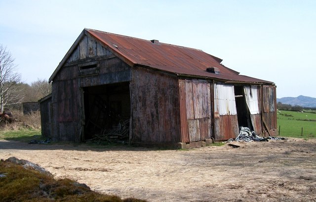
Image: © Eric Jones Taken: 10 Apr 2010
This building - which I mistook for a farm building and which stands opposite Capel Bryn-engan chapel - was in fact the Bryn-engan Primary School. I am grateful to Ms G. Williams for the information. Ms Williams writes: "This is not an old barn, it used to be the Brynengan Primary School. The school closed it doors in September 1964 and I was one of the five pupils that were there on that day. The structure of the building remains the same as I remember it. I was also a member of the Bryn-engan Chapel and attended Sunday School there. My sister remains a member of the chapel."
Images are licensed for reuse under creativecommons.org/licenses/by-sa/2.0
Image Location
Latitude
52.969086
Longitude
-4.305063