At Gamston Bridge
Introduction
The photograph on this page of At Gamston Bridge by Kate Jewell as part of the Geograph project.
The Geograph project started in 2005 with the aim of publishing, organising and preserving representative images for every square kilometre of Great Britain, Ireland and the Isle of Man.

There are currently over 7.5m images from over 14,400 individuals and you can help contribute to the project by visiting https://www.geograph.org.uk
At Gamston Bridge
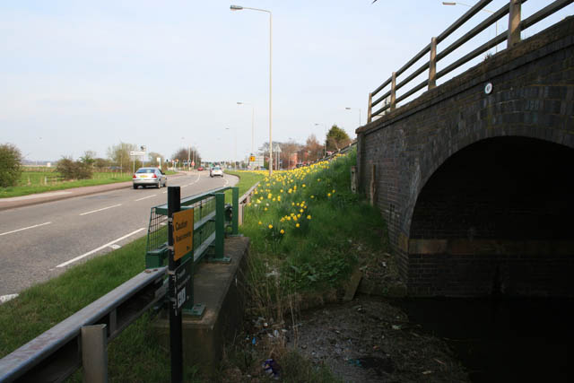
Image: © Kate Jewell Taken: 10 Apr 2010
Looking east from the twin bridge (number 4 and 4A) you can easily see what the problem is to the reopening of the Grantham Canal at this point. Bridge number 4A, on the right, carrying the Nottingham bound carriageway of Radford Road over the canal, is high enough to allow craft to pass underneath. A major obstacle to the reopening of the canal is Bridge 4 which can be seen on the left. This was constructed as a culvert during the dualling of Radcliffe Road with scant regard for future use of the waterway. This is the main reason why a feasibility study to look into alternative routes to the River Trent was carried out in 2009.
Images are licensed for reuse under creativecommons.org/licenses/by-sa/2.0
Image Location
Latitude
52.931117
Longitude
-1.109726