Bingham Road (Croydon) Station
Introduction
The photograph on this page of Bingham Road (Croydon) Station by Ben Brooksbank as part of the Geograph project.
The Geograph project started in 2005 with the aim of publishing, organising and preserving representative images for every square kilometre of Great Britain, Ireland and the Isle of Man.

There are currently over 7.5m images from over 14,400 individuals and you can help contribute to the project by visiting https://www.geograph.org.uk
Bingham Road (Croydon) Station
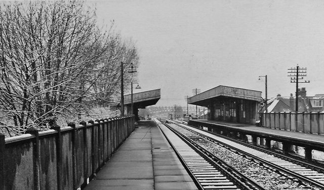
Image: © Ben Brooksbank Taken: 2 Apr 1968
View northward, towards Woodside; Woodside - Sanderstead loop line. Station built 30/9/35 when line electrified, closed 16/5/83; line replaced in part by Croydon Tramlink (opened 5/00) but here it runs at road level.
Images are licensed for reuse under creativecommons.org/licenses/by-sa/2.0
Image Location
Latitude
51.378824
Longitude
-0.073542