St. Constantine's Well
Introduction
The photograph on this page of St. Constantine's Well by John Brightley as part of the Geograph project.
The Geograph project started in 2005 with the aim of publishing, organising and preserving representative images for every square kilometre of Great Britain, Ireland and the Isle of Man.

There are currently over 7.5m images from over 14,400 individuals and you can help contribute to the project by visiting https://www.geograph.org.uk
St. Constantine's Well
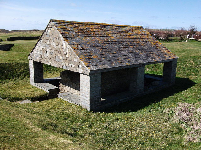
Image: © John Brightley Taken: 4 Apr 2010
There is quite a substantial barrel vaulted stone wellhead structure below the roof which I assume is modern. The ground all around was very soggy at the time I took the photo. According to a North Cornwall District Council leaflet, the well was buried for centuries under the dunes until rediscovered by local archaeologists in 1911. It was mentioned in the Domesday Book and its miraculous waters attracted pilgrims who prayed for rain in times of drought. The well now sits in the middle of a golf course, accessed by the public only by a dead-end footpath, and surprisingly there are no information boards at the site.
Images are licensed for reuse under creativecommons.org/licenses/by-sa/2.0
Image Location
Latitude
50.534818
Longitude
-5.014