Salcombe Estuary and town from Snape Point
Introduction
The photograph on this page of Salcombe Estuary and town from Snape Point by Colin Vosper as part of the Geograph project.
The Geograph project started in 2005 with the aim of publishing, organising and preserving representative images for every square kilometre of Great Britain, Ireland and the Isle of Man.

There are currently over 7.5m images from over 14,400 individuals and you can help contribute to the project by visiting https://www.geograph.org.uk
Salcombe Estuary and town from Snape Point
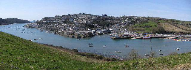
Image: © Colin Vosper Taken: 9 Apr 2010
From near the photographer's position a railway line base was dug and laid to bring a train service close to Salcombe. If it had been completed it would have been a similar situation as that developed in Dartmouth and Kingswear. The train line would have been provided to serve town and help it to develop but the railway line would have ended across the water from the town it was serving. The trainline project was abandoned and Snape Point today remains a haven of peace with no development only superb views of this flooded river valley seen here on a fine spring, April morning.
Images are licensed for reuse under creativecommons.org/licenses/by-sa/2.0
Image Location
Latitude
50.239886
Longitude
-3.767162