Plaque on Webster Fountain
Introduction
The photograph on this page of Plaque on Webster Fountain by Anne Burgess as part of the Geograph project.
The Geograph project started in 2005 with the aim of publishing, organising and preserving representative images for every square kilometre of Great Britain, Ireland and the Isle of Man.

There are currently over 7.5m images from over 14,400 individuals and you can help contribute to the project by visiting https://www.geograph.org.uk
Plaque on Webster Fountain
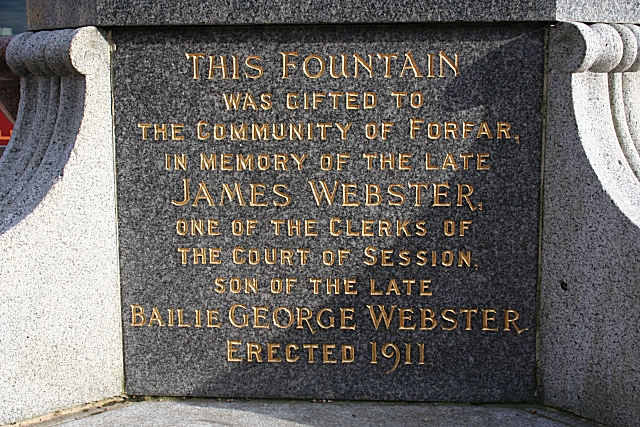
Image: © Anne Burgess Taken: 2 Apr 2010
This is the explanatory plaque on Image The Websters were prominent among the town council in the 18th and 19th centuries. For the benefit of non-Scots, a bailie, in this context, is roughly the Scottish equivalent of an alderman.
Images are licensed for reuse under creativecommons.org/licenses/by-sa/2.0
Image Location
Latitude
56.643134
Longitude
-2.889608