Callow Hill
Introduction
The photograph on this page of Callow Hill by Alan Hunt as part of the Geograph project.
The Geograph project started in 2005 with the aim of publishing, organising and preserving representative images for every square kilometre of Great Britain, Ireland and the Isle of Man.

There are currently over 7.5m images from over 14,400 individuals and you can help contribute to the project by visiting https://www.geograph.org.uk
Callow Hill
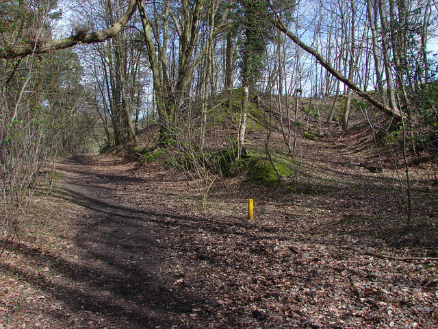
Image: © Alan Hunt Taken: 5 Apr 2010
The footpath that runs through the woods at the back of the Rose And Olive Branch pub. This area appears to have been used as landfill in the past. the yellow pipe is there to prevent build up of gas.
Images are licensed for reuse under creativecommons.org/licenses/by-sa/2.0
Image Location
Latitude
51.412218
Longitude
-0.572128