Rams Plot, Stinsford
Introduction
The photograph on this page of Rams Plot, Stinsford by Adrian Platt as part of the Geograph project.
The Geograph project started in 2005 with the aim of publishing, organising and preserving representative images for every square kilometre of Great Britain, Ireland and the Isle of Man.

There are currently over 7.5m images from over 14,400 individuals and you can help contribute to the project by visiting https://www.geograph.org.uk
Rams Plot, Stinsford
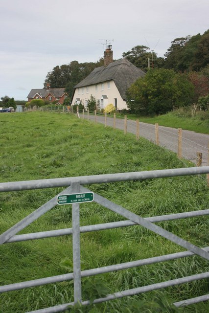
Image: © Adrian Platt Taken: 9 Sep 2009
The field, according to the sign on the gate, is called Rams Plot and is 0.8 acres in area (0.3 hectares), and is part of the estate of the Kingston Maurward College of Agriculture. The thatched cottages are grade II listed, were built as estate cottages in the C19th and can also be seen in Image
Images are licensed for reuse under creativecommons.org/licenses/by-sa/2.0
Image Location


Leaflet Map data © OpenStreetMap
Latitude
50.721714
Longitude
-2.411278