Rowley crossing on the Waskerley Way
Introduction
The photograph on this page of Rowley crossing on the Waskerley Way by Oliver Dixon as part of the Geograph project.
The Geograph project started in 2005 with the aim of publishing, organising and preserving representative images for every square kilometre of Great Britain, Ireland and the Isle of Man.

There are currently over 7.5m images from over 14,400 individuals and you can help contribute to the project by visiting https://www.geograph.org.uk
Rowley crossing on the Waskerley Way
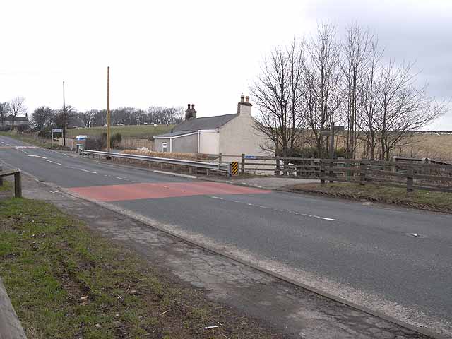
Image: © Oliver Dixon Taken: 2 Apr 2010
At this point, the disused Stanhope and Tyne Railway crosses the A68. The railway http://www.railbrit.co.uk/Stanhope_and_Tyne_Railway/frame.htm was built to serve the needs of the mining industries of north-west County Durham in the 19th century, and the massive ironworks at Consett. This part of the disused line is now known as the Waskerley Way, a component of the C2C cycle route which crosses northern England from coast to coast http://www.sustrans.org.uk/default.asp?sID=1094747349296 http://www.c2c-guide.co.uk/. In June 2009, floodwaters built up to the west of the embankment (towards camera), broke over the road, demolished the wall and severely damaged the house in the picture.
Images are licensed for reuse under creativecommons.org/licenses/by-sa/2.0
Image Location
Latitude
54.823257
Longitude
-1.863629