Cambridge Station and Spiller's Mill
Introduction
The photograph on this page of Cambridge Station and Spiller's Mill by John Sutton as part of the Geograph project.
The Geograph project started in 2005 with the aim of publishing, organising and preserving representative images for every square kilometre of Great Britain, Ireland and the Isle of Man.

There are currently over 7.5m images from over 14,400 individuals and you can help contribute to the project by visiting https://www.geograph.org.uk
Cambridge Station and Spiller's Mill
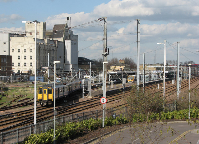
Image: © John Sutton Taken: 2 Mar 2007
A dullish photo taken three years ago has gained a little historical interest since Spiller's Mill - intended to become a cultural centre as part of the ambitious CB1 development west of the station - was largely destroyed by fire in the early hours of 27 March 2010. For an idea of the state of play at the end of March 2010, and how much of the building collapsed, see http://www.geograph.org.uk/photo/1777835, http://www.geograph.org.uk/photo/1777814 and others nearby. This picture, taken from Hills Road railway bridge, also shows, in the foreground, the edge of what was once the Cattle Market and is now the Cambridge Leisure complex, and, to the left of the train, disused sidings which have now given way to the unfinished track of the long-delayed and vastly over-budget guided-bus malarkey.
Images are licensed for reuse under creativecommons.org/licenses/by-sa/2.0
Image Location
Latitude
52.193139
Longitude
0.136461