St Swithun's Way
Introduction
The photograph on this page of St Swithun's Way by Graham Horn as part of the Geograph project.
The Geograph project started in 2005 with the aim of publishing, organising and preserving representative images for every square kilometre of Great Britain, Ireland and the Isle of Man.

There are currently over 7.5m images from over 14,400 individuals and you can help contribute to the project by visiting https://www.geograph.org.uk
St Swithun's Way
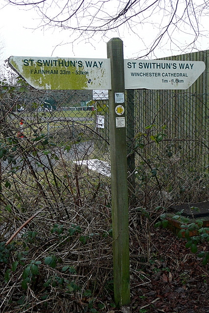
Image: © Graham Horn Taken: 14 Feb 2010
If you are heading north, one mile done, 33 to go. This is a route created by Hampshire County Council following as nearly as possible the route that pilgrims would have taken along the Itchen valley, and named after one of Winchester's most famous sons. At Farnham the route joins with the North Downs Way which will take you to Canterbury and Dover.
Images are licensed for reuse under creativecommons.org/licenses/by-sa/2.0
Image Location
Latitude
51.072603
Longitude
-1.310272