Allotments adjacent to the River Itchen
Introduction
The photograph on this page of Allotments adjacent to the River Itchen by Graham Horn as part of the Geograph project.
The Geograph project started in 2005 with the aim of publishing, organising and preserving representative images for every square kilometre of Great Britain, Ireland and the Isle of Man.

There are currently over 7.5m images from over 14,400 individuals and you can help contribute to the project by visiting https://www.geograph.org.uk
Allotments adjacent to the River Itchen
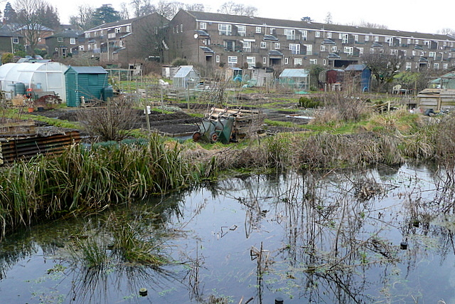
Image: © Graham Horn Taken: 14 Feb 2010
Leaving Winchester to the north, there is a significant area of allotments at Abbots Barton, running down to one of the braided streams of the River Itchen. Allotments are a unique institution, where people who do not have a garden can apply to rent a portion of Council owned land, usually a long thin strip in a throwback to Medieval strip farming practices. Many users grow vegetables and use the shed to get away from "life" for a few hours.
Images are licensed for reuse under creativecommons.org/licenses/by-sa/2.0
Image Location
Latitude
51.071801
Longitude
-1.311568