Manlove Street, Penn Fields, Wolverhampton
Introduction
The photograph on this page of Manlove Street, Penn Fields, Wolverhampton by Roger D Kidd as part of the Geograph project.
The Geograph project started in 2005 with the aim of publishing, organising and preserving representative images for every square kilometre of Great Britain, Ireland and the Isle of Man.

There are currently over 7.5m images from over 14,400 individuals and you can help contribute to the project by visiting https://www.geograph.org.uk
Manlove Street, Penn Fields, Wolverhampton
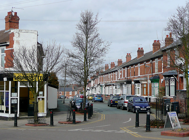
Image: © Roger D Kidd Taken: 17 Mar 2010
Much of the Penn Fields area was developed in the late nineteenth and early twentieth centuries. Most corners had a shop on, and are used as such even now, this being a multi-ethnic community in which small mini-markets and general stores are frequently found. This launderette is partly an extension onto the original corner building. It also provides key cutting services and sells locks, paint brushes, tools and Duracell batteries! Many of these solid terraced houses have been well maintained and upgraded.
Images are licensed for reuse under creativecommons.org/licenses/by-sa/2.0
Image Location
Latitude
52.577183
Longitude
-2.141857