Bedford St Johns (former) Station
Introduction
The photograph on this page of Bedford St Johns (former) Station by Ben Brooksbank as part of the Geograph project.
The Geograph project started in 2005 with the aim of publishing, organising and preserving representative images for every square kilometre of Great Britain, Ireland and the Isle of Man.

There are currently over 7.5m images from over 14,400 individuals and you can help contribute to the project by visiting https://www.geograph.org.uk
Bedford St Johns (former) Station
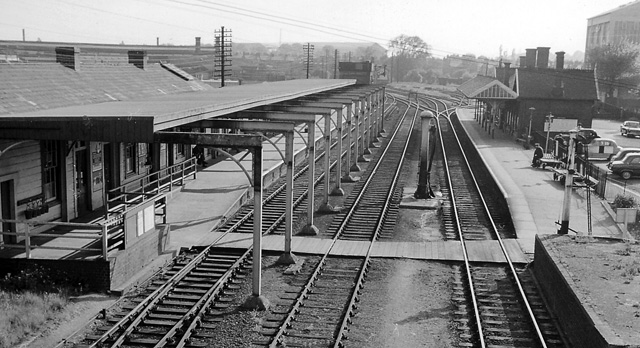
Image: © Ben Brooksbank Taken: 4 Jun 1962
Cambridge - Bletchley line, which was closed on 1/1/68, view SW towards Bletchley (left), the connection to Bedford Midland Road being to the right. This station survived as a terminus until on 14/5/84 a replacement station was opened on the loop to Midland Road station and Bletchley trains then terminated there.
Images are licensed for reuse under creativecommons.org/licenses/by-sa/2.0
Image Location
Latitude
52.128304
Longitude
-0.463743