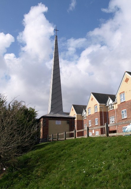
Spire Court, Plymouth
Introduction
The photograph on this page of Spire Court, Plymouth by Derek Harper as part of the Geograph project.
The Geograph project started in 2005 with the aim of publishing, organising and preserving representative images for every square kilometre of Great Britain, Ireland and the Isle of Man.
There are currently over 7.5m images from over 14,400 individuals and you can help contribute to the project by visiting https://www.geograph.org.uk

Image: © Derek Harper Taken: 27 Mar 2010
This spire is on top of a bank overlooking Blandford Road. The housing, flats for the elderly, was built in 2002 on the site of St Teresa's Roman Catholic church, which Cherry & Pevsner describe as a 1958 church, a small rectangle with an east clerestory-tower, but no mention of a fleche or spire. So I assume the spire, whose brickwork matches the flats, is contemporaneous with them and serves simply as an acknowledgment of the fact that a church stood here. Update: thanks to John Haley, who tells me that he remembers the spire was part of the church of St Teresa, and so was not built to match the flats.

