Development sites, Ormeau Road, Belfast
Introduction
The photograph on this page of Development sites, Ormeau Road, Belfast by Albert Bridge as part of the Geograph project.
The Geograph project started in 2005 with the aim of publishing, organising and preserving representative images for every square kilometre of Great Britain, Ireland and the Isle of Man.

There are currently over 7.5m images from over 14,400 individuals and you can help contribute to the project by visiting https://www.geograph.org.uk
Development sites, Ormeau Road, Belfast
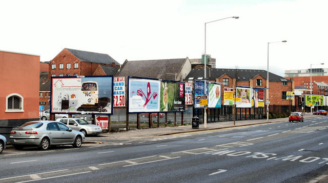
Image: © Albert Bridge Taken: 28 Mar 2010
What seems to be two separate sites between Ormeau Street (at the parked cars) and Donegall Pass. The one nearest the camera (55-71) has an application for planning permission for “7 storey mixed use development, 83 No. apartments with associated parking at ground and mezzanine level, 5 No. retail units”. The other (45-53) has a joint-agents’ board stating that it has planning permission for a “retail, office & apartment scheme”.
Images are licensed for reuse under creativecommons.org/licenses/by-sa/2.0
Image Location
Latitude
54.589867
Longitude
-5.925036