Structure alongside dismantled railway
Introduction
The photograph on this page of Structure alongside dismantled railway by Richard Dorrell as part of the Geograph project.
The Geograph project started in 2005 with the aim of publishing, organising and preserving representative images for every square kilometre of Great Britain, Ireland and the Isle of Man.

There are currently over 7.5m images from over 14,400 individuals and you can help contribute to the project by visiting https://www.geograph.org.uk
Structure alongside dismantled railway
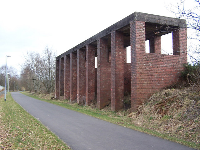
Image: © Richard Dorrell Taken: 19 Mar 2010
The road in the picture is the Maxwelltown Path - a foot and cycle path which follows the line of the dismantled Dumfries to Stranraer railway. This large disused brick built structure stands alongside the line of the railway opposite the BPI Polythene manufacturing plant. The original use of this structure is unknown to me. Suggestions gratefully received.
Images are licensed for reuse under creativecommons.org/licenses/by-sa/2.0
Image Location
Latitude
55.078946
Longitude
-3.617091