Weymouth Relief Road March 2010
Introduction
The photograph on this page of Weymouth Relief Road March 2010 by Nigel Mykura as part of the Geograph project.
The Geograph project started in 2005 with the aim of publishing, organising and preserving representative images for every square kilometre of Great Britain, Ireland and the Isle of Man.

There are currently over 7.5m images from over 14,400 individuals and you can help contribute to the project by visiting https://www.geograph.org.uk
Weymouth Relief Road March 2010
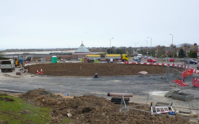
Image: © Nigel Mykura Taken: 22 Mar 2010
View south across the roundabout in state of construction at the southern access point to the new road on the Dorchester Road.The new road will come in on the left, the Dorchester Rd heading towards the coast is straight ahead and the Weymouth Way goes off to the right. The photo was taken from the southern end of Greenway Rd
Images are licensed for reuse under creativecommons.org/licenses/by-sa/2.0
Image Location
Latitude
50.634333
Longitude
-2.465717