Tunnelling shield in Cutty Sark DLR station
Introduction
The photograph on this page of Tunnelling shield in Cutty Sark DLR station by Stephen Craven as part of the Geograph project.
The Geograph project started in 2005 with the aim of publishing, organising and preserving representative images for every square kilometre of Great Britain, Ireland and the Isle of Man.

There are currently over 7.5m images from over 14,400 individuals and you can help contribute to the project by visiting https://www.geograph.org.uk
Tunnelling shield in Cutty Sark DLR station
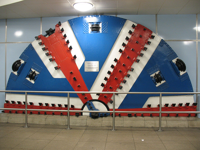
Image: © Stephen Craven Taken: 22 Mar 2010
Part of the shield used for tunnelling from Island Gardens on the north bank of the Thames to Greenwich station on the south, for the Lewisham extension of the Docklands Light Railway. It is preserved in the ticket hall (below ground level) of Cutty Sark station, along with a plaque recording the opening of the extension on 22 November 1999.
Images are licensed for reuse under creativecommons.org/licenses/by-sa/2.0
Image Location
Latitude
51.481646
Longitude
-0.011027