The Avenue
Introduction
The photograph on this page of The Avenue by Ian Capper as part of the Geograph project.
The Geograph project started in 2005 with the aim of publishing, organising and preserving representative images for every square kilometre of Great Britain, Ireland and the Isle of Man.

There are currently over 7.5m images from over 14,400 individuals and you can help contribute to the project by visiting https://www.geograph.org.uk
The Avenue
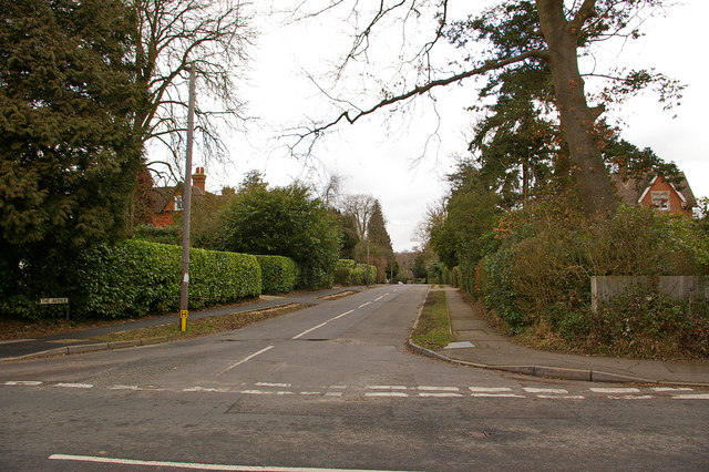
Image: © Ian Capper Taken: 6 Mar 2010
A road running from Kings Cross Lane (in the foreground in this photo) towards Nutfield Station. Although there has been some more modern infilling, most houses were built in the late 1900s, following the opening of Nutfield station in 1884. Two of the larger houses can be seen in this photo: Netherleigh on the left (see Image) and Avenue House on the right (see Image).
Images are licensed for reuse under creativecommons.org/licenses/by-sa/2.0
Image Location
Latitude
51.223787
Longitude
-0.135704