Level crossing on a hairpin bend, Risca
Introduction
The photograph on this page of Level crossing on a hairpin bend, Risca by Jaggery as part of the Geograph project.
The Geograph project started in 2005 with the aim of publishing, organising and preserving representative images for every square kilometre of Great Britain, Ireland and the Isle of Man.

There are currently over 7.5m images from over 14,400 individuals and you can help contribute to the project by visiting https://www.geograph.org.uk
Level crossing on a hairpin bend, Risca
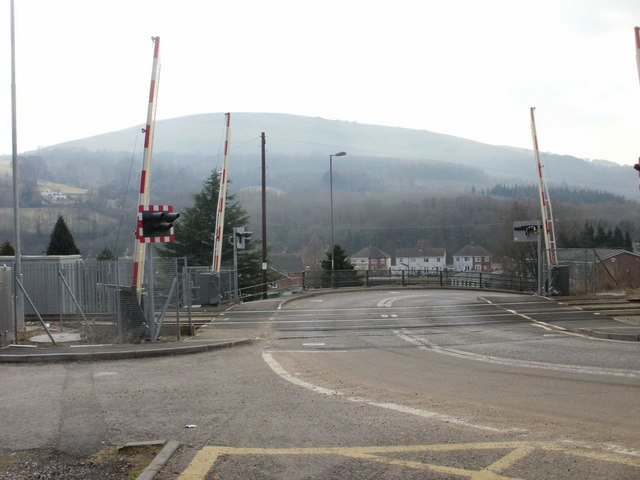
Image: © Jaggery Taken: 11 Mar 2010
Lime Kiln level crossing cuts through the middle of a hairpin bend in Darran Road's descent towards the B4591 (the western end of St Mary Street and the eastern end of Cromwell Road). The railway lines are between Risca & Pontymister station and Crosskeys station on the Cardiff Central to Ebbw Vale Parkway route. http://www.geograph.org.uk/photo/1759000 to the northern half of the hairpin bend. http://www.geograph.org.uk/photo/1759121 to the view from the southern approach. Formerly, there was a signal box next to the level crossing to control the points at the location nearby where two tracks merged into one.
Images are licensed for reuse under creativecommons.org/licenses/by-sa/2.0
Image Location
Latitude
51.616193
Longitude
-3.107739