Bench Mark, Tisbury
Introduction
The photograph on this page of Bench Mark, Tisbury by Maigheach-gheal as part of the Geograph project.
The Geograph project started in 2005 with the aim of publishing, organising and preserving representative images for every square kilometre of Great Britain, Ireland and the Isle of Man.

There are currently over 7.5m images from over 14,400 individuals and you can help contribute to the project by visiting https://www.geograph.org.uk
Bench Mark, Tisbury
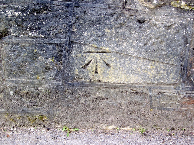
Image: © Maigheach-gheal Taken: 17 Mar 2010
The bench mark is to be found on the face of Court Street Bridge. Image and http://www.bench-marks.org.uk/bm33547 A bench mark is an Ordnance Survey arrowhead sign found on walls, bridges, churches and specially erected concrete posts where the altitude above sea-level has been accurately measured by surveyors. The arrowhead points to a horizontal line above it which marks the exact altitude.
Images are licensed for reuse under creativecommons.org/licenses/by-sa/2.0
Image Location


Leaflet Map data © OpenStreetMap
Latitude
51.065263
Longitude
-2.070875